Entry and Waiver Form
Route Map
Cue Sheet
I've often thought that a ride around the Tobacco Root Mountains would make a nice route for randonneurs. Thus I present "Search for Plummer's Gold". The name of the route derives from it's passage through Montana's rough and tumble past along the gold fields of Alder Gulch near Virginia City-one time Montana's territorial capitol. Legend has it that Virginia City's Sheriff Henry Plummer, who was accused of being the leader of an outlaw gang called the Innocents, offered to bring back his weight in gold to the Vigilantes if they spared his life. The plea fell on deaf ears, and Plummer met his end dangling from a noose in the winter of 1864. Ever since rumors have persisted, and treasure hunters have hunted, for Plummer's gold-thought to be buried somewhere in the hills around Virginia City.
The ride starts out near Three Forks at I-90 Exit 274 and goes to Ennis. In between Ennis and Three Forks is a long, but not so steep climb called Harrison Hill. This hill will get you warmed up for things to come-but with this hill there's no downhill payoff. It just gets you to the high plains around the small town of Harrison. After Norris, you hit a much steeper hill. Norris Hill kicks up to 7% grades and it does have a heart stopping downhill into the Madison Valley. But that's not all! After Ennis you start climbing-first gradually-and then in earnest as you go over a 7000 foot high-10mile long monster. The hill has a false summit-you'll actually go downhill for a little ways-but you're not done. There another mile or so of climbing before a fast descent into Virginia City.
The rest of the route flattens out on the way to Whitehall Montana in the Jefferson River valley before going over some rollers back to Three Forks. The ride has approximately 7600 feet of climbing concentrated in the three hills previously mentioned-all within the first sixty miles.
The route overlaps Adventure Cycling's Trans-America route from Ennis to Twin Bridges. In the summer months it's very likely that you will encounter cross-country touring cyclists on this stretch.
Search for Plummer's Gold Permanent (Route No. 487) is open to any RUSA member. Get in touch with me if you want to ride this route and we'll work out the details.
I rode this route for the first time on October 19, 2008 with a Garmin GPS unit. I created a map and info page with photos about this ride for Bicycling Magazine's Rides Website. Click on "trip details" on the map below to get to the info page and photos.
Wednesday, July 23, 2008
Martinsdale Mail Run 300Km Permanent (186 miles)
Entry and Waiver Form
Route Map
Cue Sheet
One of my favorite groups to ride with is the Gallatin Valley Bicycle Club touring group. We try to do a ride once a month or so in the summer. In July the touring group rode from Ringling to Martinsdale and back. It was a nice 62 mile route. When I got to looking at the route earlier this summer I realized that using the core of the touring group's ride and expanding it to Bozeman I would end up with a challenging 300 kilometer event. Thus the idea of the Martinsdale Mail Run was born.
The ride leaves from the Holiday C-Store on Durston Road in Bozeman, goes up Bridger Canyon and over Battle Ridge Pass to Wilsall. After a control in Wilsall the ride goes to the very small and unique little town of Martinsdale on US Highway 89 and the very lightly traveled and tranquil Montana Highway 294.
The ride tasks the ride with "carrying the mail" over the Bridger Mountains to Martinsdale and returning to Bozeman within the 20 hour time limit.
Standing in the way of the out and back route is Battle Ridge Pass in the Bridgers. It's a relatively short (about 2 miles on either side) but it shoots up to 6372 feet. There's also some significant hills in the vicinity of Bridger Bowl ski area to deal with. The total ride has 10,000 feet of climbing-and wind-especially around Ringling and Wilsall is usually a factor.
Any RUSA member can ride this route for RUSA distance credit. Just contact me and let me know when you want to ride-and we'll get the details sorted out from there.
I successfully rode this route for the first time on October 26, 2008 with a Garmin GPS unit. I mapped the ride and created a brief info page with photos for Bicycling Magazine's Rides Website. Click on "trip details" on the map below for the info page and photos:
Saturday, July 5, 2008
Riding my first Permanent-Success!
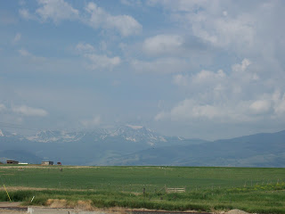 I chose July 5, 2008 to ride my Hollowtop 200 Permanent. Though I am intimately familiar with this route, this is only the second time I've ridden the entire thing in one shot.
Last night I drifted off to sleep to the sounds of fireworks going off all over town-some of my neighbors kept it going until about 1 a.m.! I awoke just before 4 a.m. to a similar, but more foreboding sound-thunder. So like any cyclist would-the first thing I did was turn on the weather channel. According to the radar map-a thunderstorm had indeed just passed through the area-but it didn't look like anymore storms were coming.
As I rode through the deserted streets to my starting point at the Main Street Town Pump I was dodging puddles-it must have rained pretty hard. The temps were in the high 50's and the air was quite humid-something we are not really used to in Montana. The air smelled a little like the morning air at my brother's home in Savannah, Georgia-except it's usually warmer and more humid there.
My biggest worry for this ride quickly turned out to be a non-issue. I was worried that the store clerks would resist stamping and signing my brevet card. Nobody out here knows what randonneuring is, and people aren't always willing to do something out-of-the-ordinary in their workplace. I could have just used a store receipt with the date and time, but I really wanted the card to be stamped-I think it just looks more official with a stamp. Anyway, the kid at the Town Pump here in Belgrade didn't think they had a stamp, but I spotted one on the back counter. He quickly retrieved it, stamped my card, and noted the time (5:00 a.m.). No problem. It would be the same at my other store controls-including my return to the Town Pump in the afternoon.
It was already starting to get pretty light as I left Belgrade City Limits, but I was equipped with lights front and back, and my new RUSA reflective sash and ankle bands...somehow I think I'm the only person who would think I looked cool. I could have rode in all dark right down the middle of the road-there were no cars out at all. Everyone must have been sleeping off their 4th of July. Starting early was a good idea.
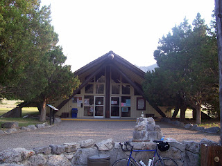 My next control was 39 miles down the road at the Lewis and Clark Caverns State Park-since I would be answering my own question at the info control-I took a few pictures just to prove I had been there and didn't take a 3 or 4 mile shortcut on I-90 .
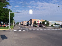
My next stop was the town of Whitehall. Folks were starting to move around as I made my way through town a little after 8 a.m. There was some sort of farmers market happening, but there were far more merchants than customers. I got some water and a turkey sandwich as well as getting my card stamped at a C-Store and then sat down in front of the fire hall and took a little break. The bank sign said it was 70 degrees-time to take the arm warmers off.
 After Whitehall, I headed back the way I came for 8 miles, before heading over the scenic and very lightly traveled Highway 359 towards Harrison and my next control in Norris. I took a picture of my route's namesake-Hollowtop Mountain, but some wildfires in Canada have put a little bit of haze in the air so the Mountain did not look as spectacular as it usually does-as you can see from the picture at the top of this page.
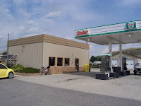
The folks at the little C-Store in Norris, McLeod Mercantile, were duly impressed with my ride. One nice old gentleman said he couldn't ride that far in one day on a motorcycle! I bought a bag of chips, some ice tea, and water and sat outside and had a little picnic. The sun was out now and it was warming up and getting breezy.
The ride after Norris goes along the Madison River and through the edge of the famous Bear Trap Recreation Area. The portion of the Madison along my route is an extremely popular river float. Traffic got very busy along this stretch as I met and was passed by people dropping off their rafts and inner tubes at the "put-in" and then heading back to the end of the float a few miles down stream. Thankfully, and according to plan, I was through this area early enough-that all the drivers were still sober. It won't necessarily be that way after they get done floating later in the afternoon.
I wasn't feeling great, but I wasn't suffering either, as I got over the very hilly portion of the ride between the Bear Trap and the Gallatin Valley, but I rallied considerably as I got to the un-chipped sealed River Road. It's amazing what a nice smooth paved surface will do for your outlook. I had headwinds through the Bear Trap-which is unusual. Every other time I have ridden through there the wind has come pretty strong out of the southwest. The wind slowed me down, but didn't hammer me too bad.
I cruised back to Belgrade and finished in a fairly respectable 8 hours and 40 minutes. My "on the bike" time was about 7 hours and 24 minutes. I could have saved some time by not taking breaks in Whitehall and Norris-but what the heck? It's not a race and I was riding alone anyway-no one else to keep up with. It is surprising though how fast time slips away when you're not moving-a lesson I'm sure, for longer rides.
All in all, I'm pretty happy with my first Permanent Route. I think it's challening and scenic. I hope some other randonneurs try it out someday.
Subscribe to:
Comments (Atom)
